Township Maps |
 |
Township Maps |
|
Warner & Beers Publishers, Chicago, 1875. Submitted by Alice Gless <agless@earthlink.net> | |
 |
|
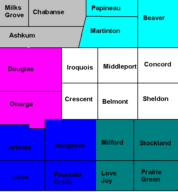
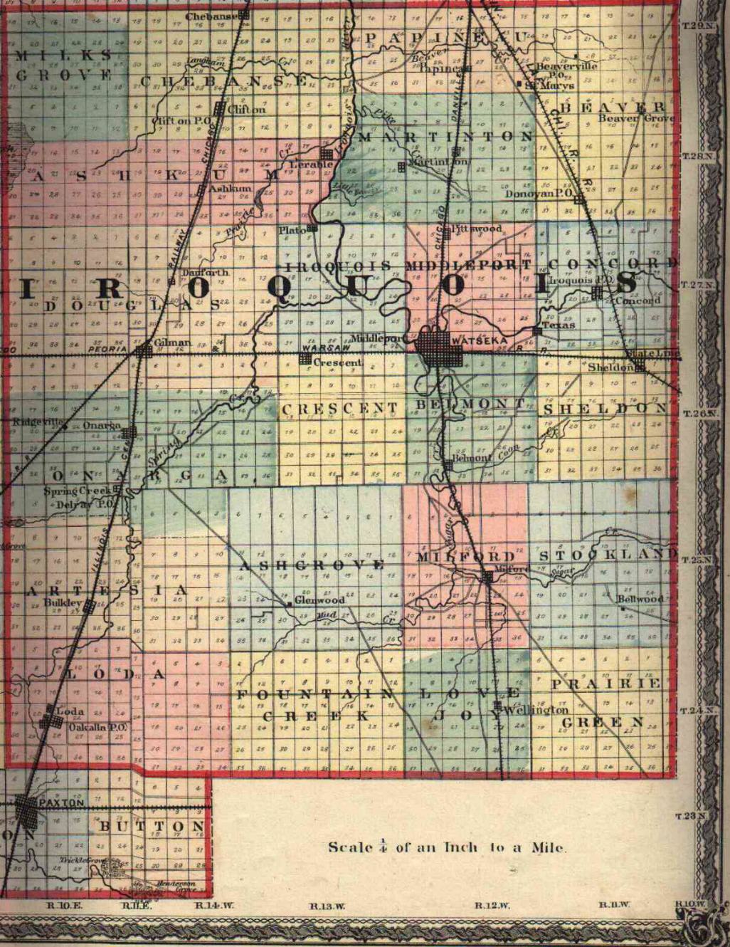
What do you do with these maps? First visit Illinois Public Domain Land Tract Sales (Iroquois is county 38 here) Or the Bureau of Land Management Land Patent Records Site and hunt for your ancestors. Jot down the Township, range and section number then come back here to our map page. Ancestor Benjamin Parker was Iroquois County, Section 8, Township 27N (T27N), Range 13W (R13W), Meridian 2. Now you find the point where T27N & R13W intersect, view the plat map for that section and walla, that little square with a number 8 on it is the section where Benjamin would have lived in 1850! The sections were divided further into section parts (eg: Section Part E2NW, Section Part E2SW) but we do not have those maps (Plat Maps) available to us at this time. | |